π Discover the world, one cache at a time!
The Magellan eXplorist 110 Handheld GPS is a robust outdoor navigation device featuring a vibrant 2.2" sunlight-readable display, waterproof design, and 2 GB of memory for storing detailed maps and geocaching information. With a battery life of up to 18 hours, this lightweight GPS is perfect for adventurers seeking reliable navigation in any environment.
Memory Storage Capacity | 2 GB |
Display Type | LCD |
Human-Interface Input | Microphone |
Control Method | Voice |
Are Batteries Included | Yes |
Supported Satellite Navigation System | GPS |
Sport Type | Fishing |
Battery Average Life | 18 Hours |
Mount Type | Magnet Mount, found in image |
Compatible with Vehicle Type | Car |
Screen Size | 2.2 Inches |
Additional Features | Waterproof |
Connectivity Technology | USB |
Map Types | Topographical |
Item Weight | 0.86 Pounds |
F**D
Good and simple
I bought this after trying an Explorist GC that was purchased locally. The GC was too focused on geocaching for my tastes. This model can be used for that, but it also is good if you just want to get out and hike, or motivate you to walk a little further/faster when exercising. It comes with a quick start booklet, but the real manual can (and should)be easily downloaded on line. It is fairly simple, but without that manual there are several customization's that I would not have figured out. Like other GPS's I've tried, it takes a while to find itself when you first turn it on if you have gone any distance from where it was turned off (or the first time out of the box.) After that, it works fine and syncs within about a minute. It was sensitive enough to pick up a signal in the house while I was reading the manual. The displays can be changed to suit what you look for and there are no maps to buy. It comes with a coupon for access to a geocaching website if you want to go that route, but you can also download the caches for free without it. All in all, I am very happy with it.Update: It's dead, Jim. After almost 5 years, it finally won't start. I have bought another Magellan for geocaching and use the 710 most of the time, but would still pull this one out every once in a while, especially when others went with me. I have always stored it without batteries to prevent damage. The last few times I booted it up, it took much longer to display anything on the screen, and now it is dead. Even after 5 years, it was still very useful for geocaching. I still recommend it.
T**O
Must have Geocaching premium account to go paperless
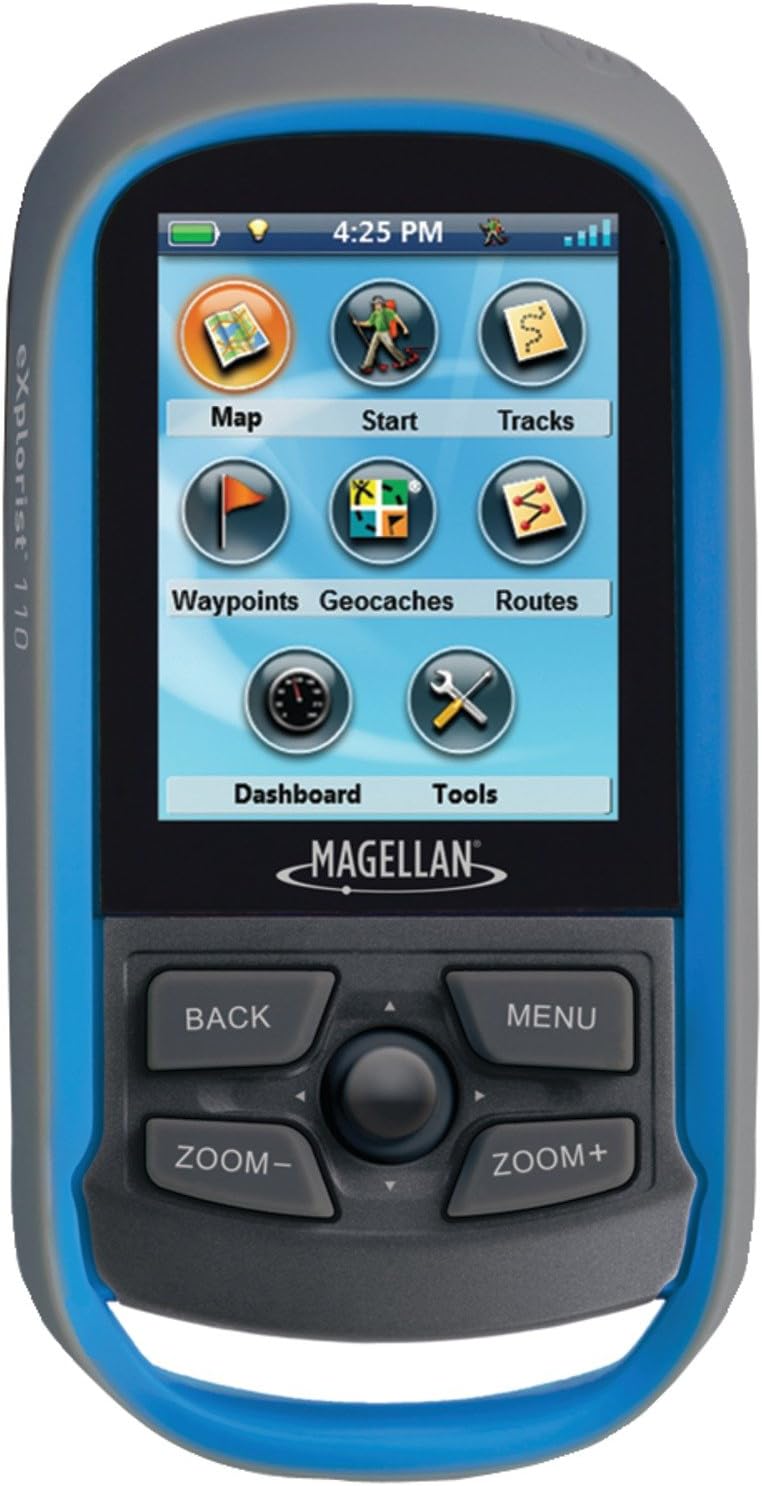
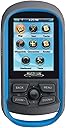
This GPS has a ton of feature for the price, which is nice. But I bought this mainly for geocaching based on the product description: Download and view more than 20 unique characteristics of each cache and view, search, filter on the device. Details include name, location, description, hider, size, difficulty, terrain, hint, and recent logs created by other geocachers. In order to fully take advantage of this function, you have to have premium account with geocaching.com. I was able to download some cache info onto this device but it wasn't a very straight forward process without premium account. (No details just name and location of each cache.) The premium account is not that expensive, but be ready to sign up if you want to do paperless. While navigating to the cache, I used dashboard view, which gave me a distant and general direction to the cache. No coordinates. Maybe because I'm so used to using the coordinates to locate the cache, it was really disappointing... Also, the tiny joystick in the middle (to select functions etc.) was not easy to use. I can't imagine using this little joystick when I had to wear gloves. I was able to find the cache, so I don't have any complaints about its accuracy. However, the experience was very frustrating, I decided to return this GPS after one cache.
C**E
Did not do what they said it would
Before we bought this we called and asked, "will this unit allow you to walk from one way point to another in a straight line". The answer was "yes". Attempting to do this with the unit, it would not work. Well, after hours on the phone with different tech support people, the conclusion was, "no". It will point toward the 2nd way point but it won't keep you aligned to it. Using a plain compass would work as well. They finally told us we needed a "three dimensional compass GPS to do this task. I spoke to three tech support people and four sales people at Magellan, asking which model I needed to get to do this, and none of them could tell me. Several of the people I spoke to had very strong accents making it very hard to understand them, and also twice when calling them they had some kind of phone line problems. I was shocked at how unprofessional they were.Also, the "joystick" was very clumsy. Many times in using it we would accidentally make the wrong choose. It's made for smaller fingers than I have. I found it very difficult and frustrating to use. Also the instructions were maddening to me. There are many pages about how to set up the appearance of your screens, but when it comes to using the device, those pages are harder to find. For instance, several tech support people said, "You're trying to do a "multileg"" Ok, a multileg. So we look at the online users guide and search it for multileg, and it's there! But it's only there in a diagram showing different line types, and what they look like on the screen as you use them. There are no other mentions of multileg anywhere in the instruction document, we searched it using an online search within the instruction document, and also manually read the entire thing.
H**E
Great device for novice
The only problems I had with the device were the descriptions of the device, Hiking and trekking are 2 different things. From a review on a Garmin 62S I found that the drift in the track was up to 80' on the Magellan it was 35' led me to believe that the device could download maps by the USB port, the USB port is for Software updates described at the MagellanGPS site, the software installed is copyrighted (c) from 2011 and the updates have nothing to do with the map, and a Dead zone on the Flume of Slides Trail in the White Mountains. Nothing surprising about that.It's a great device into exercising and competing in the outdoors with very active and detailed tracks. Start time, AVG. speed, overall, and in between Waypoints, Waypoints don't have an edit and navigate longitude and latitude; no surprise, best bet is a touchscreen navigation, but still has a downside to that as well, entering text is fairly simple and anming waypoints and tracks, didn't use geocaching, max min altimeter, Sunrise, sunset. Preference was the Garmin 62S.
Trustpilot
1 week ago
1 month ago