
DOWNLOAD THE APP


Customer Services
Copyright © 2025 Desertcart Holdings Limited
DOWNLOAD THE APP
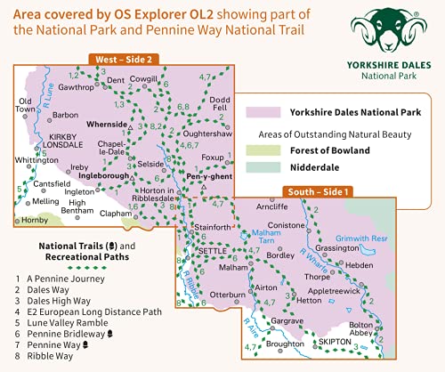
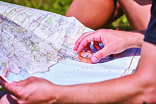
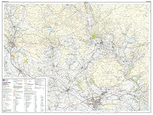
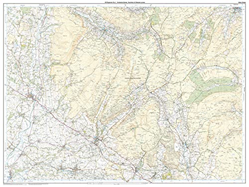


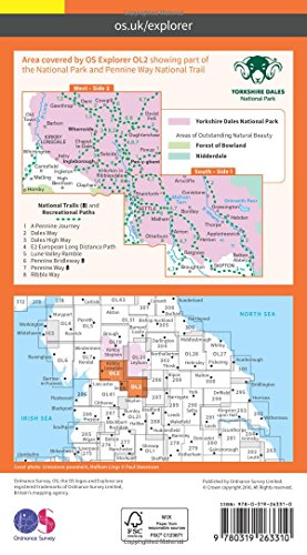


Yorkshire Dales Map | Southern & Western | Ordnance Survey | OS Explorer Map OL2 | England | Walks | Hiking | Maps | Adventure: OL02 : Ordnance Survey: desertcart.co.uk: Books Review: More than just a paper map with the digit version included - Great quality. Each map comes with a scratch panel and code underneath. This gives access to the digital version of the map on your smartphone using the free OS Maps app. This is what I use when out on my walks as it accurately track your exact location for people not as confident with map reading. An extra bonus of using the OS Maps app is that other users add walking/running/riding/etc routes so you can find lots of routes of various lengths, difficulties and ratings. It's opened up my confidence massively with exploring these beautiful areas. Review: convincing product .. love it nice - excellent map really helped in detail


| Best Sellers Rank | 10,763 in Books ( See Top 100 in Books ) 38 in Hiking (Books) 45 in Walking (Books) 101 in Travel Atlases & Maps |
| Customer reviews | 4.8 4.8 out of 5 stars (1,172) |
| Dimensions | 13.3 x 1.3 x 23.3 cm |
| Edition | 2016-08 |
| ISBN-10 | 0319263312 |
| ISBN-13 | 978-0319263310 |
| Item weight | 1.05 kg |
| Language | English |
| Print length | 1 pages |
| Publication date | 5 Sept. 2016 |
| Publisher | Ordnance Survey |
A**3
More than just a paper map with the digit version included
Great quality. Each map comes with a scratch panel and code underneath. This gives access to the digital version of the map on your smartphone using the free OS Maps app. This is what I use when out on my walks as it accurately track your exact location for people not as confident with map reading. An extra bonus of using the OS Maps app is that other users add walking/running/riding/etc routes so you can find lots of routes of various lengths, difficulties and ratings. It's opened up my confidence massively with exploring these beautiful areas.
A**R
convincing product .. love it nice
excellent map really helped in detail
M**T
Always the best
This range of maps is about the best there is for planning and overall navigation. Detailed but covering a good area. A magnifying glass is an asset as I've gotten older but the print is high quality and clear under magnification. The plastic type lamination of the map helps preserve the integrity of the maps which do split along the fold lines and if caught in the rain or on windy days can trash a map in seconds. The laminate does make the map far more bulky but personally I think the trade off is worth it. O/S maps are the best maps I've ever used. Value? What is good value nowadays? Look to buy when on offer as around £17 makes it an expensive option but hopefully will last many years of use.
J**C
OL2 Map
Good as new.
J**K
Very helpful
If you are walking in Yorkshire this shows you terrain (hills) as well as all the walking paths. Also killer feature - downloadable map for you phone!! Great investment for your trip.
B**N
You would be lost without it
Get on the right track
P**C
Great map, nice to have, but consider the OS Maps online site if you need a lot of maps.
1:25000 gives a lot of detail and this one covers some spectacular countryside, including the 3 peaks. That said, for only £20 per year, you can subscribe to OS online and have access to all OS maps, from which you can create routes and upload your own GPX route file to your GPS. It doesn't make maps redundant, but there again you can print out the areas you intend to walk from the online site. I like having a map, but on longer walks you might need quite a few and this is a consideration when backpacking. This map gives you access to downloading the map to your phone, but you can do this anyway from the OS Maps online site.
C**T
First Class.
First Class
Trustpilot
3 weeks ago
3 days ago