🌄 Navigate Boldly, Explore Freely!
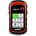
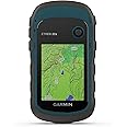
The Garmin eTrex 20 is a rugged, waterproof handheld GPS device featuring a vibrant 2.2-inch 65K color TFT display, worldwide basemaps with shaded relief, and a long-lasting 25-hour battery. Designed for outdoor enthusiasts and geocachers, it supports paperless geocaching and offers reliable navigation across global terrains.


| Memory Storage Capacity | 1740 MB |
| Display Type | LCD |
| Human-Interface Input | Buttons |
| Are Batteries Included | No |
| Supported Satellite Navigation System | GPS |
| Connectivity Protocol | Wi-Fi |
| Battery Average Life | 25 Hours |
| Mount Type | Handheld |
| Resolution | 128 x 160 |
| Compatible with Vehicle Type | Boat |
| Screen Size | 2.2 Inches |
| Additional Features | Paperless Geocaching |
| Connectivity Technology | USB |
| Map Types | Global;Topographical |
| Item Weight | 5 Ounces |
J**R
Etrex 20: An Excellent Low-Cost GPS (with update 3/8/2014)
Update 3/8/2014 Just returned from a hiking trip in Patagonia, my Etrex 20 performed extremely well. I viewed my trails on Google Earth and Map using the GPX files I recorded while walking in the cities, sailing in the lakes, hiking on the mountains and even trekking on the Perito Moreno Glacier. The maps I used are downloaded from the web links shown below.Update 8/19/2013 I have extensively used my Etrex 20 during my recent trip to the Pacific Northwest visiting many national parks with excellent performance. Both GPS and GLONASS were turned on. With full view of sky, the accuracy is 7-9 ft. During the hikes in the Olympic NP rain forest with tree tops over head, its accuracy is 20 to 30 ft.Etrex 20 is an excellent GPS unit with many features but requires a steep learning curve for a first time GPS user. These are my lessons learned:1. Make sure to download Garmin's BaseCamp and update Etrex's software via BaseCamp before doing anything else. BaseCamp is a PC program complimentary to the Etrex.BaseCamp is an excellent computer application for viewing maps, storing and organizing data, planning outdoor activities, and creating and sharing your adventures. With BaseCamp, you can:* Import and view maps in 2-D or 3-D, including your TOPO U.S. maps and City Navigator® maps.* Create, edit and organize routes, waypoints and more on your computer.* Create and share Garmin Adventures.* View playback of routes, tracks and adventures.The manual and the intro videos for BaseCamp:static.garmincdn.com/basecamp/en/Default.htmyoutube.com/playlist?list=PLz_3EG42rRDx6sN-eyPK7Gx05xYranmvv2. Free Garmin-compatible maps can be downloaded fromgarmin.openstreetmap.nl,gpsfiledepot.com,openmtbmap.org/download/odbl/#maps, andwiki.openstreetmap.org/wiki/OSM_Map_On_Garmin/Download3. There is a 3000-tile limit for the maps installed on the unit. Since installing maps to the "Garmin" folder on the SD card using MapInstall takes a long, long time, here is my trick to just install once all the maps you want and you can get access to all your maps quickly using a PC.Create a folder named "Extra Maps" inside the "Garmin" folder on the SD card, and move all extra maps you will need later into the "Extra Maps" folder. This will largely avoid exceeding the 3000 tile issues because Etrex only loads the maps in the "Garmin" folder but not the maps in the "Extra Maps" folder. You can then move maps between the two folders based on your needs.4. These programs will come in handy: GPX Editor, GPSBabel and JaVaWa Device Manager in addition to BaseCamp.
P**3
Just what I wanted for sailing and hiking
This is update to prior review. I liked the eTrek 20 a lot but a question from Amazon got me looking at the Oregon 650t as well. Got question on review saying was comparing to Oregon. My kids ended up getting me that for Christmas. It IS more expensive (a lot!) but the t model includes the 1:100K map preloaded so I can have that for travel while keeping my 1:24K map inside for use locally. Also has a camera with flash that I can use to geocashe and general use. Nice when sailing and do not want to take regular camera. The Oregon 650t has a touch screen and its screen is quite a bit larger (3 inch diagonal vs 2.2) and only slightly larger overall(.3 width and .5 length with same depth). But it is more expensive so if price a factor (and when isn't it!) then the e Trek 20 is a great choice. At the moment Oregon 650t is 4 times as expensive as the e Trek 20 on Amazon so you have to really want those added features (or get as a gift!) to choose the Oregon 650t over the e Trek 20. On other hand it does include the 1:100K topo which goes for $80-100 but even so it ends up more than double the cost. But for those of us with Kindle Fire and I Pad (have both) and used to touch screen having that is very nice. Writing this before Christmas so have not tried the Oregon yet as it is sitting under the tree. Will repost after using a while and give comparisons. As mentioned below I found the toggle on the e Trek 20 bit awkward and I kept hitting the menu button when wanting to zoom in or out (same side) but once you get used to it works great. Manuals are not great but if you are adept at all with equipment like this you will eventually figure it all out. I suspect manual issues will be same with Oregon. For less than a third the cost of the Oregon (half if you want the 1:100K topo of US) it is a great device.Old review: Use this while hiking and sailing. Took a bit of getting used to with toggle vs touch screen. Kept wanting to touch the screen. Also menu can be bit confusing until you figure it out. Lots of features did not plan on using such as the area calculation (useful in measuring grass area of yard for fertilizer) etc. Bought with both 1/100K topo of entire US which is nice while traveling. 1:24K nice for my particular area. Did find installing the maps in the micro SD bit of a challenge. Overall extremely pleased and would buy again.
T**R
Initial Opinion
I bought this for backpacking in the Rockies and doing fieldwork in Texas. This review is only based on initial familiarization and I have yet to use it much. I'm a little underwhelmed so far, but hopefully will like it more later. PROS: Nice size and good light weight for backpacking. Seems well made and durable. The controls and user interface are fairly easy to figure out. CONS: The enclosed "Quickstart Guide" is fairly useless. When you go online and actually find the appropriate real User's Manual, it's not much better. The manual for this eTrex20 model is also the manual for the eTrex10 and eTrex30, so some of the features are not applicable and it doesn't tell you this. The documentation also has errors. For example, both guides explained that you need to calibrate the compass. The menus they instruct you to follow do not exist on my model ("compass>menu>calibrate compass>start" vs. "compass>menu> and four other choices, none of which are "calibrate"). So you should expect to fumble around some unless you want to call tech support. Also, Garmin makes a big deal out of this model including their pre-loaded 1:100,000 scale topographic map. Unfortunately, its pretty useless. I don't see how you could use it for any reason. If you want a useful map, you will need to buy their 1:24,000 scale maps at around $100 each. These are not transferable between other devices, so figure the total cost of the GPS and the extra maps you are going to have to buy when you are doing comparisons with other products.As a minor note, the package does not include a lanyard. Amazon's advertisement says it does, which is an error.
Trustpilot
1 month ago
2 days ago